|
Boating Itinerary from Clear Lake Campground to the Dam by kayak, canoe, or small motor boat: One of the top things to do at Clear Lake Campground is exploring Cache Creek in a kayak, canoe, or boat. You can bring your own and dock right from Camp or rent a kayak, canoe, or small motor boat from us. This itinerary takes you from Camp to Cache Creek Dam, a distance of a little over 3 miles. Starting from Camp, turn toward the left, with Anderson Marsh on your right. You'll pass under the bridge over the highway, then you'll come to the Grigsby Riffle, a rock formation that crosses the creek near Seigler Canyon Creek. When the water is very low, the riffle sticks out and may make it difficult or impossible to cross. The riffle is used to measure the lake's water level on a scale called the Rumsey Scale. Clear Lake is considered full at 7.56 on the Rumsey Scale and the level usually varies from 1.6 to 6.75 except in very dry years where the level may go below 0. If the water is high enough, it's possible to take a detour for a short distance along Seigler Canyon Creek if you're in a kayak or canoe. Shortly after you cross the riffle, you'll pass under the Lake Street Bridge. Houses line this part of the creek for about a mile. Geese and ducks are common in this area and sometimes you may see otters swimming along. Once you pass the houses you're in a wooded area where you might see deer, wild turkeys, or even a bear on the banks. Birds are usually plentiful in the trees and on the water. In spring, fish are sometimes seen jumping out of the water, too. As you approach the dam, you'll see danger signs warning boats to stay away. Be sure to heed these warnings and don't get too near the dam. Built in 1914, the Cache Creek Dam is currently owned by Yolo County who takes water from Clear Lake via the dam unless the water level is too low. This is the end of boating access so you'll need to turn around and head back to Camp. This itinerary is part of Clear Lake Water Route 3, Rock Riffle, and Dam. The link takes you to a map and more details about the water trail. Explore more water activities: 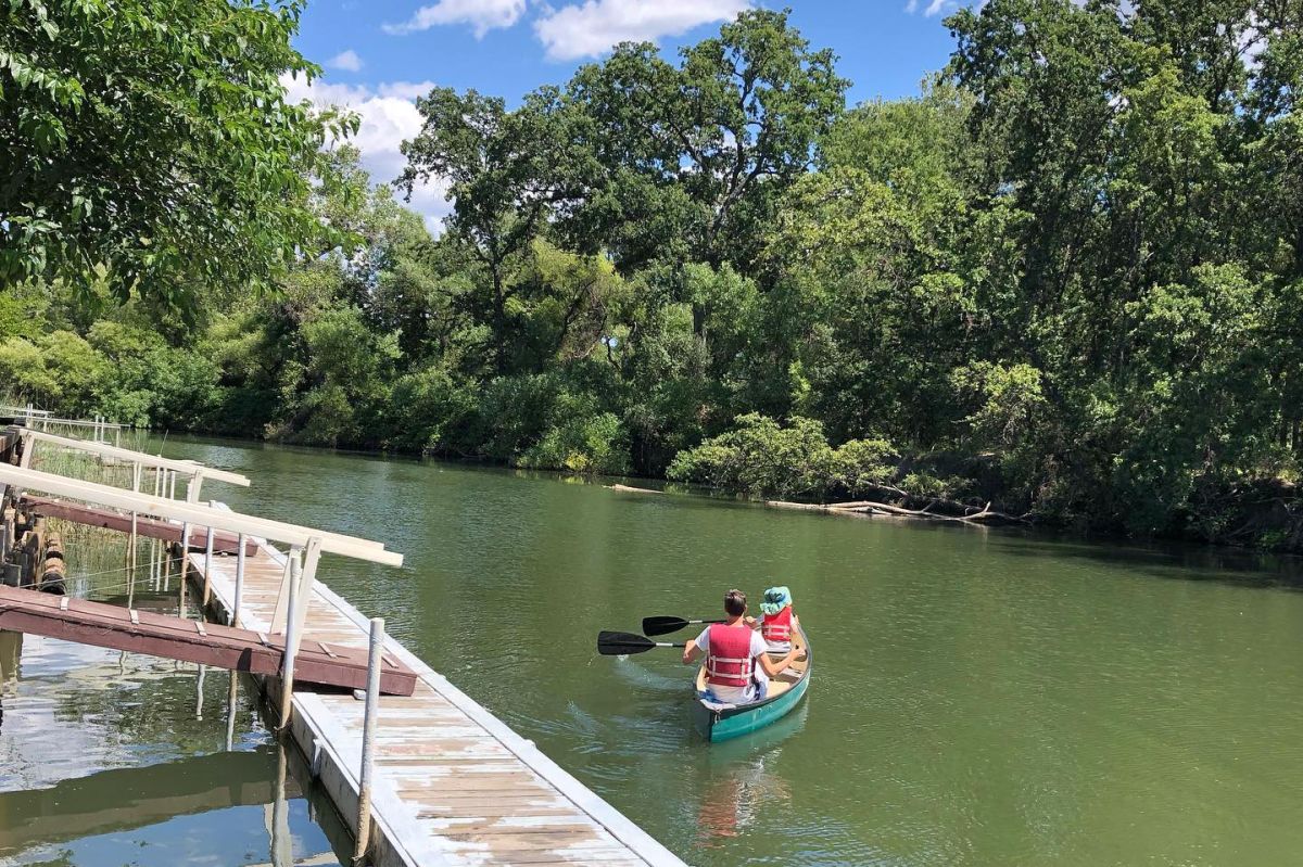
0 Comments
Leave a Reply. |
Categories
All
Archives
July 2022
AuthorMartha Bakerjian is a part-time employee at Clear Lake Campground and writes a web site about Italy: |
 RSS Feed